2026-10-30
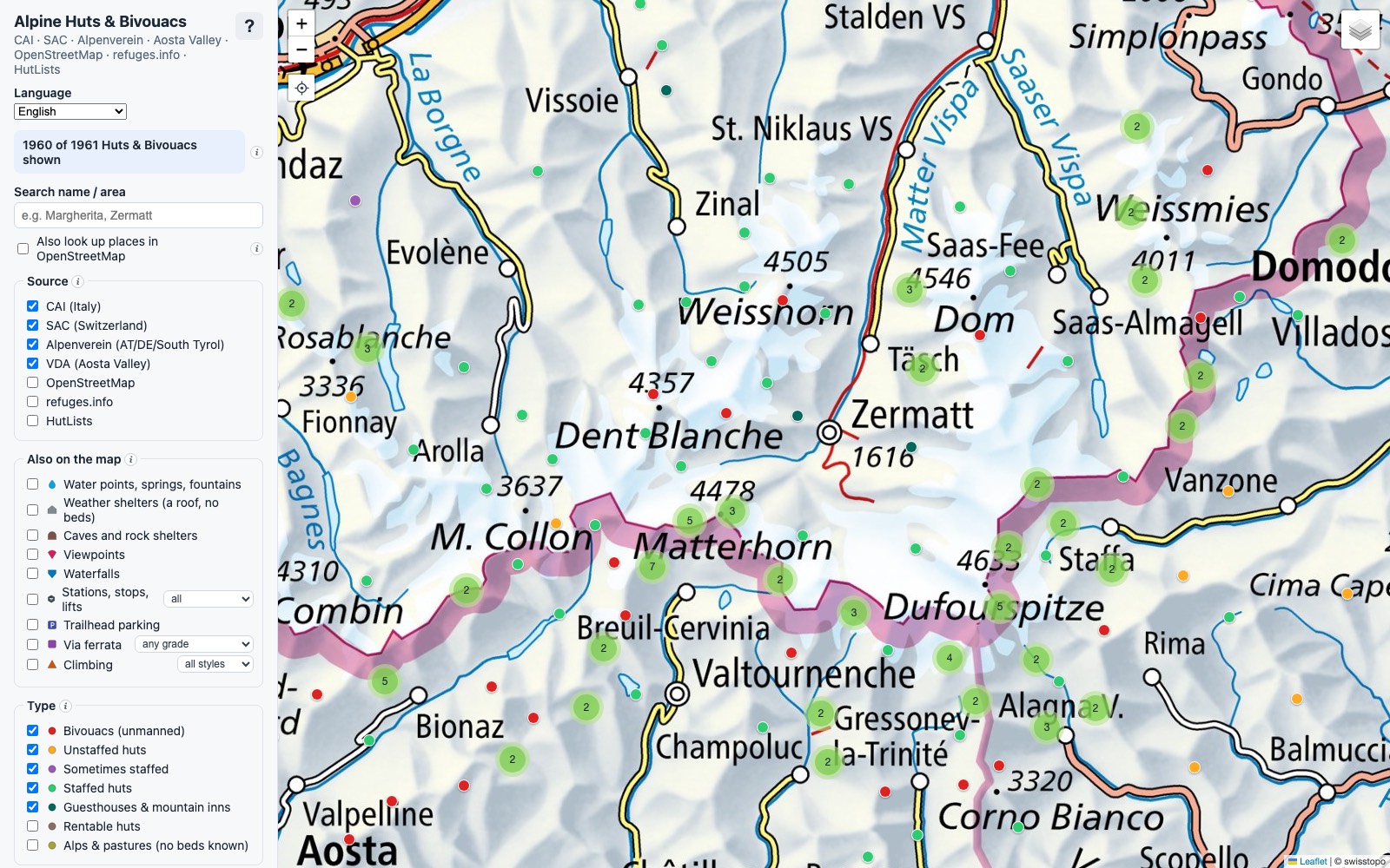
Every hut in the Alps on one map
This one isn't a customer project. It started with our own summer hike through Ticino and into Italy, and how annoying that was to plan.
A trip that crosses the border means opening a lot of tabs. The Swiss alpine club (SAC) has its own website, the Italian one (CAI) has another, and in the Aosta Valley it is the tourist board. Each has its own search and its own way of describing a hut, and none of them shows you where a hut is compared to the next one, or how long the walk between them is. The small unstaffed bivouacs, often the best places to stay, are mostly not on any of them.
So I built the map I wanted, as a hobby project in the evenings. It is free and needs no account: mismo-tech.com/huts-app.
One map, seven sources
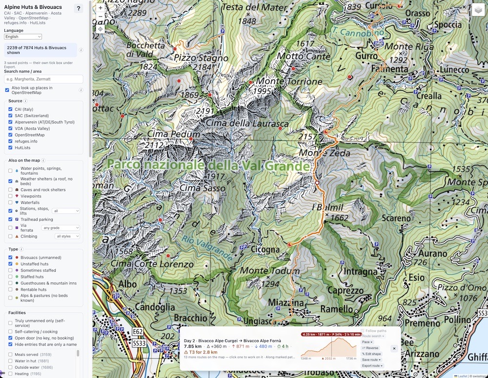
The map collects every hut and bivouac it can find in seven catalogues: CAI, SAC, the Alpenverein (Austria, Germany and South Tyrol), the Aosta Valley, OpenStreetMap, refuges.info and HutLists. That is 9,399 shelters.
Many huts are listed in more than one catalogue, under slightly different names and at slightly different coordinates. Those are merged into one marker that carries everything each source knows about it: photos, facilities, number of beds, approach routes, opening months, prices and the winter room. Italian descriptions are translated to English, and the menu works in English, German, French and Dutch.
The filters answer the questions you actually have when planning: will anyone be there? (staffed, sometimes staffed, unstaffed, bivouac), can I cook myself, is there a winter room and is it open or does it need a key, is the hut open in the month I want to go. Water points, weather shelters, via ferratas, climbing crags, car parks and bus stops are optional layers. Every category has its own marker shape, not just its own colour, so the map also works if you are colour blind.
Plan a route
Click a hut, choose Find route from here, and click the next one. The route follows real mountain paths from OpenStreetMap, and you can drag it over a different pass or bridge. The bar at the bottom shows:
- distance, ascent and descent, measured on swisstopo's terrain model in Switzerland and on Copernicus elsewhere, with an elevation profile;
- walking time, using the same SAC formula as the yellow Swiss signposts, adjusted for how heavy your pack is and for difficult ground;
- difficulty: how many kilometres of the route are T3, T4 or harder on the SAC hiking scale, so a short scramble doesn't surprise you halfway.
Let it find the tour
Picking huts one by one works for a day. For a week it is a puzzle, so the Plan a tour panel solves it for you. Tell it how many nights, how far and how much climbing you want per day, the hardest ground you will take, what kind of hut you want to sleep in, and how you are getting there: car park, bus, train or cable car. Optionally, finish where you started.
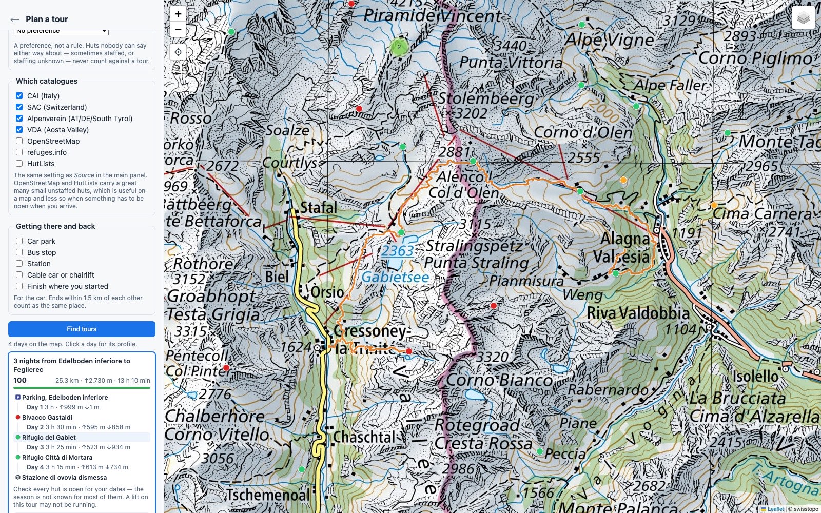
It searches a precomputed network of the walking time between every pair of huts within a day's walk, and returns ranked tours in under a second. Everything is a preference rather than a hard rule: a tour that is one hour longer than you asked for is still shown, with a plain note saying so. Click a tour to draw it on the map, click a day to see its profile.
Every tour comes with the warnings the data can't solve: check each hut is open on your dates, and check the bus and cable car are actually running.
Save, share and take it with you
Huts, your own points and routes go into collections, with notes like "bus at 7:40" or "bridge was out in June". A collection can be shared as a link, with no account needed and nothing stored on a server.
Then export it as GPX or KML and import it into the swisstopo app, Garmin, Organic Maps or komoot. That is deliberate: this is a planning tool for at home, not a navigation app for the mountains. It keeps what you have already looked at, so it still opens in the valley with no signal, but download your navigation app's offline map before you go. And take a paper map.
How it is built
- Data pipeline: Node.js scripts that fetch each catalogue, merge the duplicates, translate and export everything. No dependencies.
- Map: plain JavaScript with Leaflet, on the swisstopo base map. Routing by BRouter, terrain heights from swisstopo and open-meteo.
- Hosting: a static site behind a Cloudflare Worker on mismo-tech.com.
No cookies, no analytics, no account. Your collections and points are stored in your own browser and nowhere else.
Hut data and photos remain the property of the CAI, the SAC, the Alpenverein, the Aosta Valley tourist board and the photographers.
Open the map and plan your next trip.